

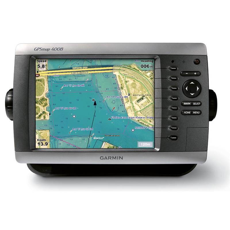
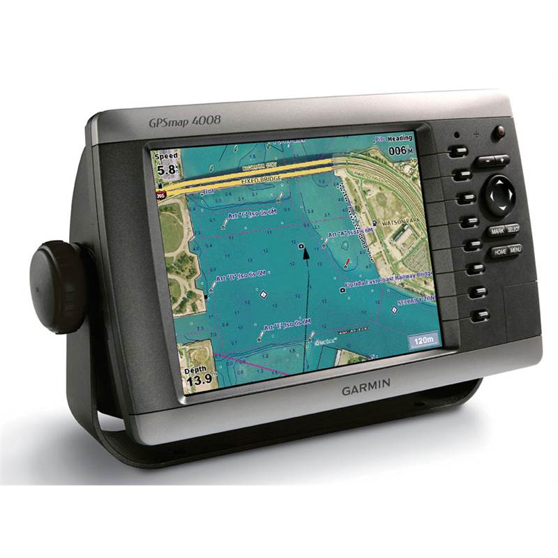
Garmin GPSMAP 4008 8.4 inch Multi-Function Display
The Garmin GPSMAP 4008 8.4 inch VGA Network Chartplotter will perform brilliantly as an impressive all-in-one central console for the Garmin Marine Network (GMN).
The GPSMAP 4008 has video-quality resolution on an 8.4-inch VGA display as well as a worldwide, satellite-enhanced basemap. By connecting to the GMN, you can add sonar, radar and weather. For even more enhanced features, you can add the optional BlueChart g2 Vision card.
The Garmin GPSMAP 4008 connects easily to the high-speed GMN, so you can interface with additional multi-function displays and add remote sensors. Once connected, you can share information between the GPSMAP 4008 and other chart plotters on your vessel.
You can also add high-powered radar, sonar and XM satellite weather and radio to your system.
The Garmin GPSMAP 4008 8.4 inch VGA Network Chartplotter features a worldwide basemap with high-quality satellite images in place of more traditional maps. For even more detail, you can add maps easily with the SD card slot without having to connect to a computer. The Garmin 4008’s high-speed processor draws maps quickly and its simple intuitive interface makes navigating easy.
To keep tabs on your engine room or other area of your vessel, you can also connect a live video feed with the 4008’s video input and output options.
With the optional BlueChart g2 Vision SD card, you can add an extra dimension of exceptional features to your Garmin GPSMAP 4008 Chartplotter.
Key Features
- 8.4-inch display size
- Fully networkable with radar, sonar, instruments and other Garmin 4000 and 5000 series displays
- NMEA 2000 and NMEA 0183 compliant
- Worldwide satellite basemap
- Optional wireless remote control
- GPS17x NMEA 2000 antenna included
Features
- 3D mariner’s eye view or fish eye view provides you with 3-D perspective of map information, both above and below waterline
- High-resolution satellite images and aerial photographs help you orientate yourself in unfamiliar areas
- Auto Guidance technology searches through all relevant charts to create route you can actually follow that avoids obstacles, shallow water, buoys and other obstructions
Specification
- Screen size: 8.4-inch diagonal
- Display type: 4096 colour-capable VGA, sunlight-readable
- Resolution: 640 x 480 pixels
- 1200 nits of brightness
- Backlit keypad for easier operation at night
- 1 x VGA PC monitor video output
- Dimensions (H x W x D): 17.8 H x 28.5 W x 11.7 D cm
Contents
- GPSMAP 4008 plotter
- Flush mount
- Bail mount
- GPS17x NMEA 2000 exterior antenna with pole mount adapter
- Power cable
- NMEA 0183 cable
- Video cable assembly
- Marine grommet kit
- Protective front cover
- Owner's manual
- Installation instructions
Unavailable