Information on finding accommodation, camping, food. Directions to the start. Also Ranger Service contact numbers and enlargements of towns/villages showing facilities available and tips on weather and clothing Detailed mapping, full legend. National Grid - can be used with GPS. 1:40,000 scale. Waterproof. Supplied in clear plastic pocket
Selected maps are available in the new XT40 edition, a tough, polythene matrial. Leap forward in technical excellence. Tough, light and 100% wateproof Compact and light - the map itself weighs just 60gms - a third of the weight of a laminated map, and much less bulky. And you can fold or refold it time and again, or stuff it in your back pocket and it won't fall to pieces. Shows the entire route on one sheet. See items with 'XT40' next to the name.
 Great Glen Way XT40 Great Glen Way XT40
117km (73 miles) from Fort William to Inverness via Fort Augustus along the Caledonian Canal and the north side of Loch Ness.
isbn: 978185137 4632 |
 Speyside Way XT40 Speyside Way XT40
144km (90 miles) from Aviemore to Buckie, via Nethybridge, Grantown and Fochabers, with a spur to Tomintoul.
isbn: 978185137 4878 |
 West Highland Way XT40 West Highland Way XT40
The Way is 153km (95 miles) from Milngavie, near Glasgow to Fort William.
isbn: 978185137 4588 |
 St Cuthberts Way XT40 St Cuthberts Way XT40
The Way links places associated with the life of the 7th century saint, Cuthbert. From Melrose Abbey to Holy Island (Lindisfarne). 100km (62 miles).
isbn: 978185137 4748 |
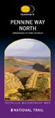 Pennine Way North Pennine Way North
Just 3 HARVEY maps cover the whole 268-mile route. Each covers a section of the Way suitable for a comfortable week of walking. Each starts and finishes near public transport, so no hassle with getting lifts.
isbn: 978185137 4212 |
 Pennine Way Central Pennine Way Central
Just 3 HARVEY maps cover the whole 268-mile route. Each covers a section of the Way suitable for a comfortable week of walking. Each starts and finishes near public transport, so no hassle with getting lifts.
isbn: 978185137 4267 |
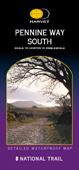 Pennine Way South Pennine Way South
Just 3 HARVEY maps cover the whole 268-mile route. Each covers a section of the Way suitable for a comfortable week of walking. Each starts and finishes near public transport, so no hassle with getting lifts.
isbn: 978185137 4311 |
 Pennine Bridleway South Pennine Bridleway South
Map of the 73 mile (117km) southern section of this new National Trail. Covers the part of the route opened on 27 May 2004, from Derbyshire to the South Pennines, plus the 47 mile (75km) Mary Townley Loop, which was completed in 2003.
isbn: 978185137 4069 |
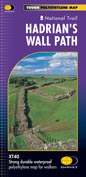 Hadrians Wall Path XT40 Hadrians Wall Path XT40
Entire route on one map. 130km (81 miles) from the Solway Coast to Newcastle
isbn: 978185137 4380 |
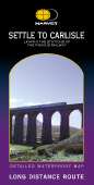 Settle to Carlisle Settle to Carlisle
The route starts in picturesque Settle and passes through the beautiful Yorkshire Dales and the sheltered Eden Valley, ending in central Carlisle.
isbn: 978185137 4168 |
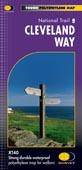 Cleveland Way XT40 Cleveland Way XT40
174km (109 miles) from Helmsley across the North York Moors National Park to Saltburn and along the coast via Scarborough ending at Filey.
isbn: 978185137 4892 |
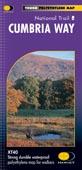 Cumbria XT40 Cumbria XT40
The Cumbria Way is 112km (70 miles) from Ulverston to Carlisle. It passes through Coniston, Dungeon Ghyll, Keswick and Caldbeck. Mostly through valleys rather than over high tops.
isbn: 978185137 4243 |
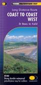 Coast to Coast West XT40 Coast to Coast West XT40
Covers the section from St Bees to Keld. Includes alternative routes.
isbn: 978185137 4885 |
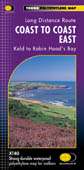 Coast to Coast East XT40 Coast to Coast East XT40
Covers the 96 mile section from Keld to Robin Hood's Bay. Includes alternative routes.
isbn: 978185137 4830 |
 Dales Way XT40 Dales Way XT40
130km (81 miles) from Ilkley in Yorkshire through the Dales via Grassington, Buckden and Dent to Bowness on Windermere in the Lake District. Contains all 3 links: from Leeds, Shipley (Bradford) and Harrogate
isbn: 978185137 46324281 |
Nidderdale Way
 85km (53 mile) loop around the River Nidd valley in North Yorkshire. The route passes Scar House and Gowthwaite Reservoirs and runs close to the amazing rock formations at Brimham Rocks. 85km (53 mile) loop around the River Nidd valley in North Yorkshire. The route passes Scar House and Gowthwaite Reservoirs and runs close to the amazing rock formations at Brimham Rocks.
isbn: 978185137 3925 |
 Offa's Dyke Path North Offa's Dyke Path North
Offa's Dyke Path runs from sea to sea - the Severn Estuary to Liverpool Bay. For about 70 miles the Path follows the course of what was originally an 8m ditch and rampart. Castles, forts and historic sites dot the route. 2 HARVEY maps cover the whole 177 mile route. Each map covers a section suitable for about a week of walking. Offa's Dyke Path North covers the route from Prestatyn to Knighton.
isbn: 978185137 4519 |
 Offa's Dyke Path South XT40 Offa's Dyke Path South XT40
Offa's Dyke Path runs from sea to sea - the Severn Estuary to Liverpool Bay. For about 70 miles the Path follows the course of what was originally an 8m ditch and rampart. Castles, forts and historic sites dot the route. Two HARVEY maps cover the whole 177 mile route. Each map covers a section suitable for about a week of walking. Offa's Dyke Path South covers the route from Knighton to Chepstow (on the Severn).
isbn: 978185137 5028 |
 Pembrokeshire Coast Path XT40 Pembrokeshire Coast Path XT40
The map shows the entire route St Dogmaels to Amroth on one sheet. Pembrokeshire Coast Path covers nearly 200 miles of the most spectacular scenery in Britain. It was Wales' first long distance route and is one of the 15 premier UK National Trails.
isbn: 978185137 4595 |
 Cotswold Way XT40 Cotswold Way XT40
166km (103miles) of winding trail through the Cotswolds from Chipping Campden to Bath, passing through Broadway, Winchcombe, Stroud, Wooton-under-Edge and Chipping Sodbury.
isbn: 978185137 4182 |
 Ridgeway XT40 Ridgeway XT40
From Overton Hill near Avebury in Wiltshire to Ivinghoe Beacon, east of Tring in Hertfordshire 137km (85 miles).
isbn: 978185137 4786 |
 North Downs Way (West) North Downs Way (West)
The Way is 251km (156 miles). This map covers the western half (115km, 71 miles) from Farnham, Surrey to the bridge over the river Medway at Rochester, Kent.
isbn: 978185137 3673 |
 North Downs Way (East) North Downs Way (East)
The Way is 251km (156 miles). This map covers the Eastern half (131km, 82 miles) from Dover to the bridge over the river Medway at Rochester, Kent.
isbn: 978185137 3796 |
 South Downs Way XT40 South Downs Way XT40
162km (101 miles) between Winchester and Eastbourne. Suitable for walkers, cyclists and horse riders with alternative routes clearly shown.
isbn: 978185137 4779 |
 South West Coast Path 1 South West Coast Path 1
6 HARVEY maps will cover the whole 630-mile route. Each map covers a section of the Path suitable for 8-9 days of walking. Map 1 covers the Path from the start at Minehead to Bude.
isbn: 978185137 4229 |
 South West Coast Path 2 South West Coast Path 2
6 HARVEY maps will cover the whole 630-mile route. Each map covers a section of the Path suitable for 8-9 days of walking. Map 2 covers the Path from Bude to Portreath
isbn: 978185137 4274 |
 South West Coast Path 3 South West Coast Path 3
6 HARVEY maps will cover the whole 630-mile route. Each map covers a section of the Path suitable for 8-9 days of walking. Map 3 covers the Path from Portreath via Land's End to Lizard Point
isbn: 978185137 4328 |
 South West Coast Path 4 South West Coast Path 4
6 HARVEY maps will cover the whole 630-mile route. Each map covers a section of the Path suitable for 8-9 days of walking. Map 4 covers the Path from Lizard to Plymouth
isbn: 978185137 4373 |
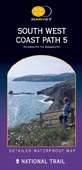 South West Coast Path 5 South West Coast Path 5
6 HARVEY maps will cover the whole 630-mile route. Each map covers a section of the Path suitable for 8-9 days of walking. Map 5 covers the Path from Plymouth to Sidmouth.
isbn: 978185137 4427
|
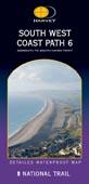 South West Coast Path 6 South West Coast Path 6
6 HARVEY maps will cover the whole 630-mile route. Each map covers a section of the Path suitable for 8-9 days of walking. Map 6 covers the Path from Sidmouth to South Haven Point.
isbn: 978185137 4472 |
|
|


 HARVEY National Rail and long distance routes