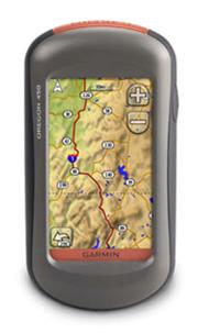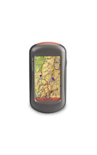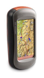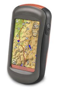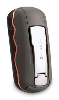
The Garmin Oregon 450 Handheld GPS Unit is a superb handheld GPS whose impressive features include a durable sunlight-readable touchscreen along with a built-in basemap with shaded relief, a high-sensitivity receiver, a barometric altimeter, a 3-axis electronic compass, a microSD card slot and a picture viewer.
The slim and lightweight Garmin Oregon 450 Handheld GPS Unit also enables you to swap tracks, waypoints, routes and geocaches wirelessly with similar units.
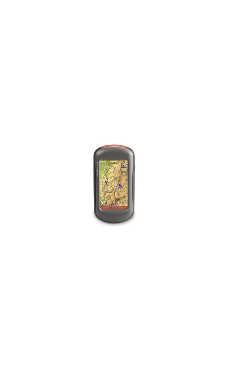
The 3-inch diagonal colour touchscreen display of the Garmin Oregon 450 offers crystal-clear enhanced colours and high-resolution images and, in combination with an easy-to-use interface, this means you will be able to spend more time enjoying the outdoors and less time searching for information.
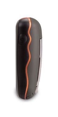
The Garmin Oregon 450 Handheld GPS Unit enables you to customise the appearance of your display but it is not only convenient but robust as well, having been built to withstand any weather and to cope with knocks, dust, dirt, humidity and water.
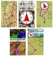
The Garmin Oregon 450 is supplied with a built-in worldwide basemap with shaded contours so you simply touch the colour screen to navigate your way. The digital elevation maps show you shaded contours at higher zoom levels so you are provided with a big picture of the surrounding terrain.
The Garmin Oregon 450 Handheld GPS Unit enables you to wirelessly share your waypoints, tracks, routes and geocaches with other compatible Garmin Oregon, Colorado and Dakota users. You can send the details of your favourite hike to a friend to enjoy or the location of a cache to find. Sharing data is very easy as you just touch 'send' to transfer your information to similar units.
The Garmin Oregon 450 supports Geocaching.com GPX files for downloading geocaches and details straight to your unit. By going paperless, you are not only helping the environment but also improving your own efficiency. The Oregon 450 stores and displays key information including location, terrain, difficulty, hints and descriptions, which means you no longer having to enter coordinates manually or having to cope with soggy paper print outs in wet weather. Simply upload the GPX file to your unit and you are ready to start hunting for caches.
You can share photos of your excursions with the Garmin Oregon 450 picture viewer.
The Garmin Oregon 450 Handheld GPS Unit has a built-in three-axis tilt-compensated electronic compass, which shows your heading without holding it level and even when you are standing still. Its barometric altimeter tracks changes in pressure to pinpoint your precise altitude and you can even use it to plot barometric pressure over time, which can help you keep an eye on changing weather conditions.
The Garmin Oregon 450 enables you to see changes in elevation ahead of you as well as where you have been with enhanced track navigation. With its high-sensitivity, WAAS-enabled GPS receiver and HotFix satellite prediction, the Garmin Oregon 450 locates your position quickly and precisely and maintains its GPS location even under heavy tree cover and in deep valleys.
The Garmin Oregon 450 makes it convenient to plug in optional compatible pre-loaded microSD cards for all your outdoor activities on land or on water. For example, just insert a MapSource card with detailed street maps and the Oregon provides turn-by-turn directions to your destination.
You can also add selected topographic maps to take advantage of a 3-D map view which gives you a better perspective of your elevation.
With Garmin BlueChart g2, you will get everything you need for a great day on the water including depth contours, navigation aids and harbours. The card slot is located inside the waterproof battery compartment so you don't have to worry about getting it wet.
When you have been busy exploring, you will want to store and perhaps analyse your activities. With a simple connection to your computer and to the Internet, you can get a detailed analysis of your activities and send tracks to your outdoor device using the Garmin Connect website. This user-friendly site offers an activity table and allows you to view your activities on a map using Google Earth. You can also explore other routes uploaded by millions of Garmin Connect users and share your experiences on Twitter and Facebook.
The Garmin Oregon 450 Handheld GPS Unit is a superb handheld GPS whose impressive features include a durable sunlight-readable touchscreen along with a built-in basemap with shaded relief, a high-sensitivity receiver, a barometric altimeter, a 3-axis electronic compass, a microSD card slot and a picture viewer.
The slim and lightweight Garmin Oregon 450 Handheld GPS Unit also enables you to swap tracks, waypoints, routes and geocaches wirelessly with similar units.
The 3-inch diagonal colour touchscreen display of the Garmin Oregon 450 offers crystal-clear enhanced colours and high-resolution images and, in combination with an easy-to-use interface, this means you will be able to spend more time enjoying the outdoors and less time searching for information.
The Garmin Oregon 450 Handheld GPS Unit enables you to customise the appearance of your display but it is not only convenient but robust as well, having been built to withstand any weather and to cope with knocks, dust, dirt, humidity and water.
The Garmin Oregon 450 is supplied with a built-in worldwide basemap with shaded contours so you simply touch the colour screen to navigate your way. The digital elevation maps show you shaded contours at higher zoom levels so you are provided with a big picture of the surrounding terrain.
The Garmin Oregon 450 Handheld GPS Unit enables you to wirelessly share your waypoints, tracks, routes and geocaches with other compatible Garmin Oregon, Colorado and Dakota users. You can send the details of your favourite hike to a friend to enjoy or the location of a cache to find. Sharing data is very easy as you just touch 'send' to transfer your information to similar units.
The Garmin Oregon 450 supports Geocaching.com GPX files for downloading geocaches and details straight to your unit. By going paperless, you are not only helping the environment but also improving your own efficiency. The Oregon 450 stores and displays key information including location, terrain, difficulty, hints and descriptions, which means you no longer having to enter coordinates manually or having to cope with soggy paper print outs in wet weather. Simply upload the GPX file to your unit and you are ready to start hunting for caches.
You can share photos of your excursions with the Garmin Oregon 450 picture viewer.
The Garmin Oregon 450 Handheld GPS Unit has a built-in three-axis tilt-compensated electronic compass, which shows your heading without holding it level and even when you are standing still. Its barometric altimeter tracks changes in pressure to pinpoint your precise altitude and you can even use it to plot barometric pressure over time, which can help you keep an eye on changing weather conditions.
The Garmin Oregon 450 enables you to see changes in elevation ahead of you as well as where you have been with enhanced track navigation. With its high-sensitivity, WAAS-enabled GPS receiver and HotFix satellite prediction, the Garmin Oregon 450 locates your position quickly and precisely and maintains its GPS location even under heavy tree cover and in deep valleys.
The Garmin Oregon 450 makes it convenient to plug in optional compatible pre-loaded microSD cards for all your outdoor activities on land or on water. For example, just insert a MapSource card with detailed street maps and the Oregon provides turn-by-turn directions to your destination.
You can also add selected topographic maps to take advantage of a 3-D map view which gives you a better perspective of your elevation.
With Garmin BlueChart g2, you will get everything you need for a great day on the water including depth contours, navigation aids and harbours. The card slot is located inside the waterproof battery compartment so you don't have to worry about getting it wet.
When you have been busy exploring, you will want to store and perhaps analyse your activities. With a simple connection to your computer and to the Internet, you can get a detailed analysis of your activities and send tracks to your outdoor device using the Garmin Connect website. This user-friendly site offers an activity table and allows you to view your activities on a map using Google Earth. You can also explore other routes uploaded by millions of Garmin Connect users and share your experiences on Twitter and Facebook.