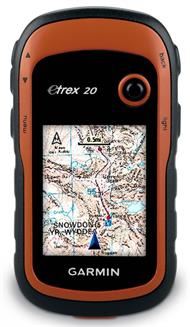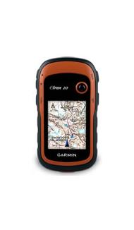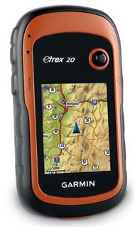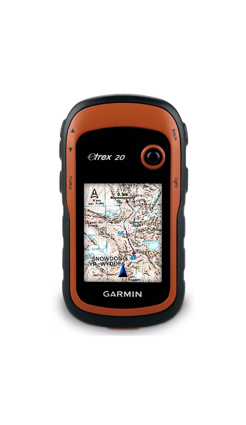
The Garmin eTrex 20 Handheld GPS Unit boasts a simple user interface, increased mapping capabilities and paperless geocaching as well as an enhanced 2.2-inch 65K colour, brilliant, sunlight-readable display.
The Garmin eTrex 20 is also able to withstand the worst of the weather as it is waterproof and it is tough enough to cope with outdoor knocks and drops.
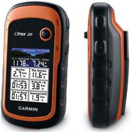
Thanks to its microSD card slot and 1.7 GB of internal memory, the Garmin eTrex 20 GPS can be loaded with the Garmin range of Ordnance Survey maps such as Garmin GB Discoverer for off-road walks or City Navigator NT map data for turn-by-turn routing on roads or BlueChart g2 pre-loaded cards for waterborne trips.
A high-sensitivity, EGNOS-enabled GPS receiver and HotFix satellite prediction mean the eTrex 20 locates your position quickly and precisely and maintains its GPS location even in heavy forest cover and steep-sided valleys.
A range of compatible Garmin mounts enable you to use the Garmin eTrex 20 GPS on a bike, a motorbike, a boat, in a road vehicle or an off-road vehicle.
The Garmin eTrex series is the first ever consumer-grade receiver range that can track both GPS and GLONASS satellites simultaneously. GLONASS is a system developed by the Russian Federation that has been fully operational since 2012. When using GLONASS satellites, the time it takes for the receiver to lock onto a position is on average approximately 20% faster than using GPS. And when using both GPS and GLONASS, the receiver has the ability to lock on to 24 more satellites than if using GPS alone.
The Garmin eTrex 20 Handheld GPS Unit features paperless geocaching by supporting GPX files for downloading geocaches and details straight to your unit. By going paperless, you're not only helping the environment but also making your geocaching much more fun. the eTrex 20 stores and displays all the information you need, including location, terrain, difficulty, hints and descriptions, which means no more manually entering coordinates and dealing with paper printouts. Simply upload the geocache to your unit and start hunting for caches.
The Garmin eTrex 20 Handheld GPS Unit boasts a simple user interface, increased mapping capabilities and paperless geocaching as well as an enhanced 2.2-inch 65K colour, brilliant, sunlight-readable display.
The Garmin eTrex 20 is also able to withstand the worst of the weather as it is waterproof and it is tough enough to cope with outdoor knocks and drops.
Thanks to its microSD card slot and 1.7 GB of internal memory, the Garmin eTrex 20 GPS can be loaded with the Garmin range of Ordnance Survey maps such as Garmin GB Discoverer for off-road walks or City Navigator NT map data for turn-by-turn routing on roads or BlueChart g2 pre-loaded cards for waterborne trips.
A high-sensitivity, EGNOS-enabled GPS receiver and HotFix satellite prediction mean the eTrex 20 locates your position quickly and precisely and maintains its GPS location even in heavy forest cover and steep-sided valleys.
A range of compatible Garmin mounts enable you to use the Garmin eTrex 20 GPS on a bike, a motorbike, a boat, in a road vehicle or an off-road vehicle.
The Garmin eTrex series is the first ever consumer-grade receiver range that can track both GPS and GLONASS satellites simultaneously. GLONASS is a system developed by the Russian Federation that has been fully operational since 2012. When using GLONASS satellites, the time it takes for the receiver to lock onto a position is on average approximately 20% faster than using GPS. And when using both GPS and GLONASS, the receiver has the ability to lock on to 24 more satellites than if using GPS alone.
The Garmin eTrex 20 Handheld GPS Unit features paperless geocaching by supporting GPX files for downloading geocaches and details straight to your unit. By going paperless, you're not only helping the environment but also making your geocaching much more fun. the eTrex 20 stores and displays all the information you need, including location, terrain, difficulty, hints and descriptions, which means no more manually entering coordinates and dealing with paper printouts. Simply upload the geocache to your unit and start hunting for caches.