The leisure-GPS for hikers and bikers
Whether in the city jungle or on faraway mountain paths, TEASI one3 shows the route — easy, reliably and in all European countries.
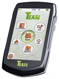
A well-devised menu structure and a simply designed user interface make Teasi One to an easy-to-use navigator for outdoors. No complicate and time consuming setup of the device – Teasi One is fully operational right out of the box.
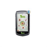
Teasi One combines 4 profiles in 1 device: Bike, hike, ski & boat. Thereby outdoor friends reach their destination comfortably both on land, in the snow and on the water – easily, reliably and in all European countries.
Tell your Teasi who you are - it shows you where you need to go: Thanks to intelligent routing Teasi One leads you on the path that is the best for you, no matter how you move. After setting your profile for biking, hiking, skiing or paddling Teasi One calculates the most appropriate route for the respective activity. So you don't have to bump along unpaved paths from pothole to pothole with your precious racing bike and can experience sufficient action across country with your mountain bike.
Set your destination in three different ways: By entering an address, as a point directly on the map or via GEO coordinates.
You have an hour to spare and want to cover a distance of 5 miles? Today you want fully to accelerate and burn calories for a pizza or a beer? Teasi One suggests you a route exactly according to your own desires!
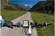
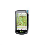
Record your bike tour with the help of the trip computer. This also provides a GPS compass so that you never lose the orientation.
Furthermore Teasi One provides extensive information about your distance, speed, grade, altitude, calorie consumption and much more.
Thanks to the faster Bluetooth 4.0 connection Teasi One can be connected with external sensors such as heart rate or speed and cadence sensors and the transferred data are reliably evaluated on the device. Keep an eye on your physical performance and increase your training workload in order to reach your optimal level.
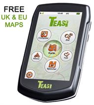
Via the 8.8cm (3.5") transflective touch display of Teasi One you can see everything you need at a glance.
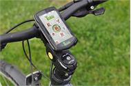
The Teasi One is not affected if it will rain on your bike or hiking tour or get slightly wet while paddling. Teasi One has a splash-proof housing, so don't worry!
Riding longer tours without dead battery? No problem with Teasi One because the 2.650mAh strong battery lasts up to 12 hours depending on intensity of use.
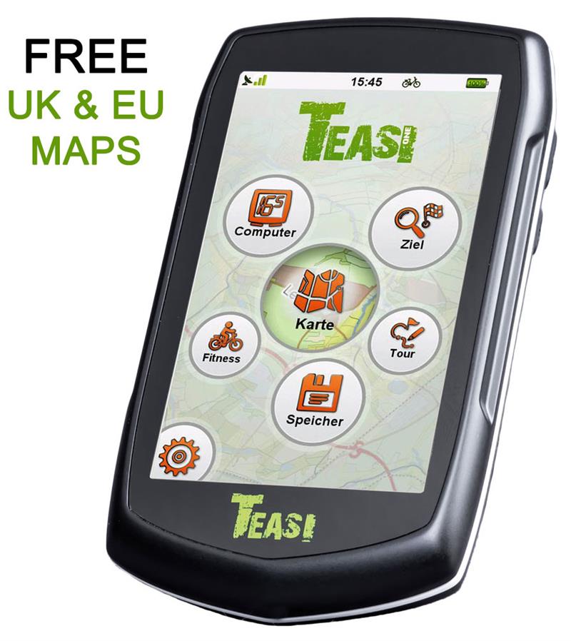
No worries is probably the best way to put it: On Teasi One all countries of Central Europe are already preinstalled as routable maps. Via the central update and management tool you can expand and update these maps for free. Stay always up to date – easily and for free.
The next holiday is waiting and even there you want actively hike or combine a bike trip with a paddling tour? Unfortunately you don't know which routes lead you to the most beautiful places. Also here your Teasi One helps you. You can plan your own tours with the Tour Creator in the TOOL and enrich them with individual points of interest, pictures and descriptions.
As well with communities such as bikemap.net, wandermap.net, GPSies or RouteYou you can have a look on tour tips of million users and easily download the most attractive routes to your Teasi One.
You can even write your own reports about your outdoor holiday and upload interesting biking or hiking tours as Teasi Tour (with pictures, texts and POIs) for download for other users.
The leisure-GPS for hikers and bikers
Whether in the city jungle or on faraway mountain paths, TEASI one3 shows the route — easy, reliably and in all European countries.
A well-devised menu structure and a simply designed user interface make Teasi One to an easy-to-use navigator for outdoors. No complicate and time consuming setup of the device – Teasi One is fully operational right out of the box.
Teasi One combines 4 profiles in 1 device: Bike, hike, ski & boat. Thereby outdoor friends reach their destination comfortably both on land, in the snow and on the water – easily, reliably and in all European countries.
Tell your Teasi who you are - it shows you where you need to go: Thanks to intelligent routing Teasi One leads you on the path that is the best for you, no matter how you move. After setting your profile for biking, hiking, skiing or paddling Teasi One calculates the most appropriate route for the respective activity. So you don't have to bump along unpaved paths from pothole to pothole with your precious racing bike and can experience sufficient action across country with your mountain bike.
Set your destination in three different ways: By entering an address, as a point directly on the map or via GEO coordinates.
You have an hour to spare and want to cover a distance of 5 miles? Today you want fully to accelerate and burn calories for a pizza or a beer? Teasi One suggests you a route exactly according to your own desires!
Record your bike tour with the help of the trip computer. This also provides a GPS compass so that you never lose the orientation.
Furthermore Teasi One provides extensive information about your distance, speed, grade, altitude, calorie consumption and much more.
Thanks to the faster Bluetooth 4.0 connection Teasi One can be connected with external sensors such as heart rate or speed and cadence sensors and the transferred data are reliably evaluated on the device. Keep an eye on your physical performance and increase your training workload in order to reach your optimal level.
Via the 8.8cm (3.5") transflective touch display of Teasi One you can see everything you need at a glance.
The Teasi One is not affected if it will rain on your bike or hiking tour or get slightly wet while paddling. Teasi One has a splash-proof housing, so don't worry!
Riding longer tours without dead battery? No problem with Teasi One because the 2.650mAh strong battery lasts up to 12 hours depending on intensity of use.
No worries is probably the best way to put it: On Teasi One all countries of Central Europe are already preinstalled as routable maps. Via the central update and management tool you can expand and update these maps for free. Stay always up to date – easily and for free.
The next holiday is waiting and even there you want actively hike or combine a bike trip with a paddling tour? Unfortunately you don't know which routes lead you to the most beautiful places. Also here your Teasi One helps you. You can plan your own tours with the Tour Creator in the TOOL and enrich them with individual points of interest, pictures and descriptions.
As well with communities such as bikemap.net, wandermap.net, GPSies or RouteYou you can have a look on tour tips of million users and easily download the most attractive routes to your Teasi One.
You can even write your own reports about your outdoor holiday and upload interesting biking or hiking tours as Teasi Tour (with pictures, texts and POIs) for download for other users.